
Discover Europe's Best Off-Grid Camping Spots with AI
Find quiet places. Leave a useful note. Keep wild camping responsible.
Product Visuals
Mobile screenshots from the Wildora Journey app.

Responsible DiscoveryA calm map-first experience for wild camping 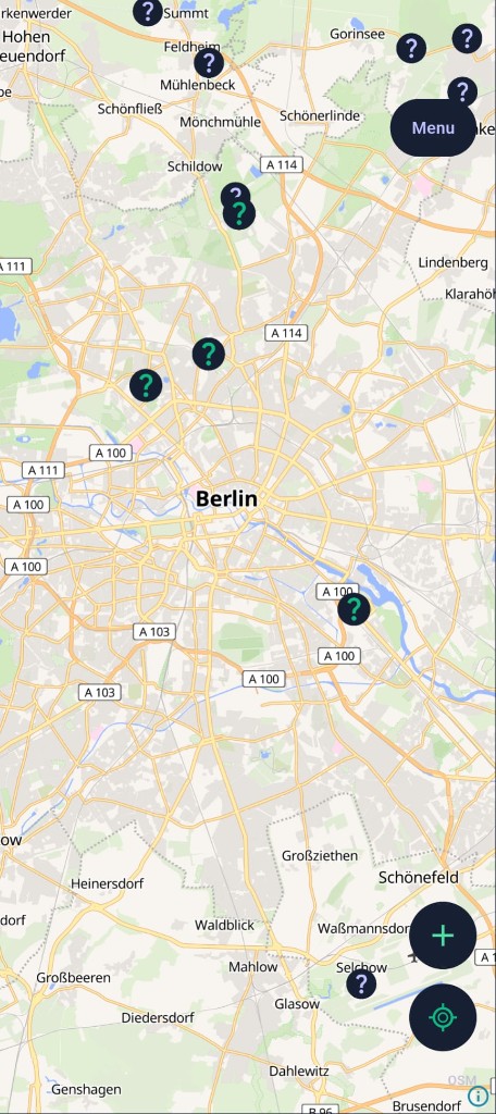
European Map ViewExplore curated spots across the continent 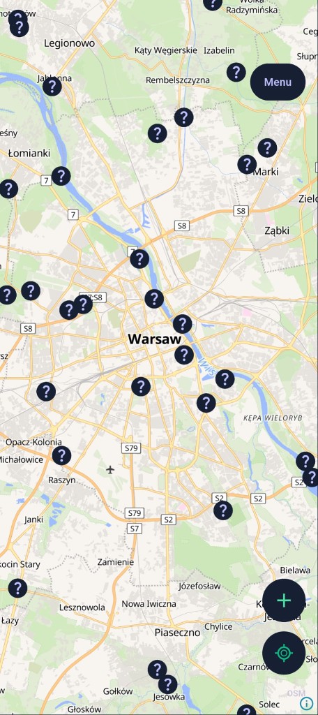
Spot Detection EngineAI-scored mystery markers waiting to be discovered
About Wildora Journey
Wildora Journey is an AI-assisted mobile map for discovering quiet off-grid camping locations across Europe. Behind the app, an automated ML pipeline ingests OpenStreetMap geography and satellite imagery, scores candidate coordinates, and validates wild-camping suitability — surfacing only high-confidence spots on the map. Users explore mystery markers, discover unnamed places by submitting the first review with photos, pin favorites, and add new locations in the field.
Register or browse as a guest, explore the interactive map (MapLibre + OpenStreetMap), tap AI-scored mystery markers to open location details, write photo-rich reviews (up to 5 photos), and sync discoveries and pins across devices when logged in.
Technology
- Mobile app
- Flutter (iOS & Android), MapLibre GL, offline SQLite cache
- API (lightweight)
- Go (Gin), PostgreSQL + PostGIS, JWT auth
- AI / ML pipeline
- Python (Django), XGBoost + GeoFM (PyTorch cross-attention), VLM vision review, Qdrant embeddings
- Geospatial AI
- GeoFM fuses satellite imagery + 16 OSM spatial features; Clay Foundation geospatial model (planned)
- Cloud (AWS)
- S3 (wildora-imagery satellite tiles, wildora-img review photos), EC2 for embedding servers
- Data sources
- OpenStreetMap, Park4Night, Natural Earth; ~124k+ ML-labeled spots, automated discovery pipeline
How It Works
Our AI pipeline finds and validates wild-camping spots before they reach the map.
Ingest & Analyze
OpenStreetMap geography + satellite imagery processed into spatial features (road distance, forest proximity, land use)
AI Scoring
GeoFM multimodal model cross-attends satellite imagery with geography; automated pipeline scores and validates candidates via vision-language review
Discover & Share
Validated spots appear as mystery markers on the mobile map; community explorers name them with photo reviews
Features

Spot Detection Engine
AI-scored locations from satellite imagery + OSM spatial intelligence (~124k+ labeled dataset)

European Map View
Full-screen MapLibre map with mystery markers across the continent

Photo Reviews
Up to 5 photos per review, direct-to-S3 upload via lightweight Go API

Off-Grid Recommendations
GPS-centered discovery, proximity checks, cross-device pin sync